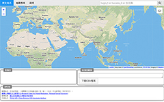
開發者:林農堯
工具簡介:本工具可提供使用者查詢歷史地名的地理空間資訊,當中介接了哈佛大學中國歷史地理信息系統(TGAZ),法鼓文理學院地名規範資料庫(DILA),以及臺灣歷史地名資訊系統(TWGIS),提供包含臺灣及中國的歷史地名,並可將查詢的結果匯出供 DocuGIS 或其它 GIS 工具使用。
 |
 |
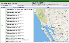
開發者: 馮永輝
工具簡介:本工具可提供使用者單獨或批次查詢歷史地名的地理空間資訊,使用者可以UTF-8格式的純文字txt檔上傳200筆以內的地名(一行一個地名),系統將自動從哈佛大學中國歷史地理信息系統(TGAZ)、法鼓文理學院地名規範資料庫(DILA),或是臺灣歷史地名資訊系統(TWGIS)中查詢該歷史地名的權威編號與座標。使用者可將這些資料勾選並匯出以作為後續的利用。
 |
 |

開發者:林農堯、馮永輝、賴思頻
TWGIS簡介 |
哈佛大學的China Historical GIS placename database提供了豐富的大中華區域的歷史地名,但其收錄的台灣歷史地名並不多,無法真正將地理時空資訊技術運用在台灣歷史的人文研究上。因此,我們建置了TWGIS台灣歷史地名資料庫。
我們採用中央研究院《臺灣歷史文化地圖系統》中授權的歷史地名圖資,並整合東華大學提供之東部地名資料,補足較為缺乏的東部地名,使資料更加完備。
TWGIS提供了三個主要時期(1684~1894、1895~1926、1953~1999)與四階行政階層(廳、堡、街庄、土名)的地名資料。我們替每筆地名資料訂定唯一編號(ID),並加入地名、時間、行政區級別與上層行政區的等資訊。
TWGIS API是一個php腳本,它接受http/https請求,並返回json格式的資料,可透過指定地名ID或者名稱,取得台灣歷史地名的資料。
|
API使用方式 |
https://docusky.org.tw/DocuSky/extApi/GeoCode/TWGIS/tw.php?n=[query]
n 為欲檢索項目,可以輸入 1~44523 之間的數字或者地名。
檢索項目是否帶有 twgis_ 前綴,不影響檢索結果。
合法檢索範例:n=123, n=twgis_123, n=台北, n=twgis_台北
|
API返回資料 |
| 項目 |
說明 |
| system |
API開發方:Research Center for Digital Humanities, National Taiwan University。 |
| memo |
此次查詢的檢索詞。 |
| count of displayed results |
顯示的檢索結果條目數。 |
| count of total results |
檢索結果條目總數。 |
| placenames |
sys_id |
twgis條目的id。 |
| url |
檢索此條目的API。 |
| name |
地名。 |
| transcription |
- |
| years |
地名存在的時間區間。 |
| parent sys_id |
上級行政區id。(現無使用) |
| parent name |
上級行政區地名。(現無使用) |
| feature type |
地點類型:POINT。 |
| xy coordinates |
經緯度座標。 |
| data source |
資料來源:中央研究院,《臺灣歷史文化地圖系統》第一版,(台北,中央研究院,2003年9月)& Research Center for Digital Humanities, National Taiwan University。 |
|
範例 |
檢索:https://docusky.org.tw/DocuSky/extApi/GeoCode/TWGIS/tw.php?n=台北
返回:
{
"system": "Research Center for Digital Humanities, National Taiwan University",
"memo": "Results for query matching key '台北'",
"count of displayed results": "3",
"count of total results": "3",
"placenames": [
{
"sys_id": "twgis_1600",
"url": "https://docusky.org.tw/DocuSky/extApi/GeoCode/TWGIS/tw.php?n=twgis_1600",
"name": "臺北",
"transcription": "",
"years": "190111 ~ 190910",
"parent sys_id": "",
"parent name": "",
"feature type": "POINT",
"xy coordinates": "121.5028806,25.0502404",
"data source": "中央研究院,《臺灣歷史文化地圖系統》第一版,(台北,中央研究院,2003年9月)& Research Center for Digital Humanities, National Taiwan University."
},
{
"sys_id": "twgis_12367",
"url": "https://docusky.org.tw/DocuSky/extApi/GeoCode/TWGIS/tw.php?n=twgis_12367",
"name": "臺北",
"transcription": "",
"years": "1904 ~ ",
"parent sys_id": "",
"parent name": "",
"feature type": "POINT",
"xy coordinates": "121.51597,25.04919236",
"data source": "中央研究院,《臺灣歷史文化地圖系統》第一版,(台北,中央研究院,2003年9月)& Research Center for Digital Humanities, National Taiwan University."
},
{
"sys_id": "twgis_28797",
"url": "https://docusky.org.tw/DocuSky/extApi/GeoCode/TWGIS/tw.php?n=twgis_28797",
"name": "臺北",
"transcription": "",
"years": "1894 ~ 1895",
"parent sys_id": "",
"parent name": "",
"feature type": "POINT",
"xy coordinates": "121.5077828,25.0512468",
"data source": "中央研究院,《臺灣歷史文化地圖系統》第一版,(台北,中央研究院,2003年9月)& Research Center for Digital Humanities, National Taiwan University."
}
]
}
|
| |
|
|
|


